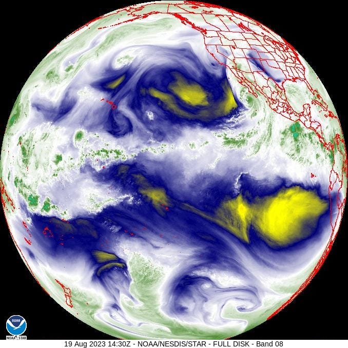
Hurricane Hilary will shortly be classified as a tropical storm but it will remain a very powerful and impactful storm — mainly due to the massive amount of rain that will fall in locations that are typically very dry. If you are in the zone of impact pay close attention to the National Weather Service and local emergency management.
The National Hurricane Center just said of Hilary (8AM EDT, 19 Aug):
CATASTROPHIC AND LIFE-THREATENING FLOODING LIKELY OVER BAJA CALIFORNIA AND THE SOUTHWESTERN U.S. THROUGH MONDAY
Hilary will surely be widely covered by the “climate beat” so to help place that coverage into the context of research and climate history, here are some points and pointers:
Ryan Maue is the single best follow on Substack for all things tropical and frequent discussion of weather more broadly. You can find his daily updates at his new Weather Substack. I’ve known Ryan for over a decade, collaborated with him (and Jessica Weinkle) and can report that he really knows his stuff — Highly recommended.
You may have heard that Hilary is the first tropical cyclone for which a tropical storm watch was issued for Southern California. This is true, but it says more about the history of National Hurricane Center practices than it does about climatology — the NHC first started issuing such watches in 1987.
Southern California was hit by powerful tropical cyclones — perhaps even approaching hurricane strength — in 1939 and 1858. Storms which made landfall in Mexico and later had large impacts on the U.S. Southwest are common — the powerful 1939 storm was just one of four tropical cyclones that affected Southern California that year.
I wrote up a Twitter (Xitter?) thread with resources for climate reporters. Of course, lead a horse to water and all that. In a nutshell, tropical cyclone events in northern Mexico and the U.S. Southwest:
Are common;
There is no long-term trend in frequency, intensity or rainfall;
In the science literature there is no asserted or hypothesized detection/attribution;
There are many precedents;
There is a strong ENSO relationship, with U.S. impacts more likely during El Niño conditions.
Some resources for those wanting support for the summary above or to simply dive deeper and learn more:
In 1980 NOAA published a technical memorandum titled, TROPICAL CYCLONE EFFECTS ON CALIFORNIA, which stated: “Tropical cyclones have a much larger effect on the climate of the southwestern United States than is realized by many people, including some meteorologists and climatologists” — Fascinating, not least because it comes from an era when history and data mattered more than modeled futures and simplistic claims of attribution. (PDF)
NOAA: “This report describes the effects that 84 documented eastern north Pacific TCs had on the SW United States from 1900-84” (PDF)
Research: "More TCs are able to track farther westward and northward during El Niño years" (link)
Research: "Changes in mechanisms and characteristics of western US floods over the last sixty years" (tl;dr = apart from snow related runoff “relatively stable over the last 60 years”) (link)
USGS: Santa Cruz River, Pima County, Arizona: "The 100-year flood during El Nino-Southern Oscillation conditions is 1,300 cubic meters per second, more than double the value for other years. The increase is mostly caused by an increase in recurvature of dissipating tropical cyclones into the Southwestern United States ..." (PDF)
Research: Precedents: “35 eastern Pacific TCs and their remnants could be tracked into the SW US between 1958 and 2003" (link)
Large impact precedent: NOAA: “The Tucson, Arizona, Flood of October 1983” (link)
For resources on tropical cyclones more generally, see my 2023 Edition: What the media won't tell you about . . . hurricanes which summarizes what IPCC and NOAA actually say about hurricanes.
For those really, really wanting to associated Hilary with climate change — given data, research and history, it is a difficult case to make. However, here are some suggestions for how the linkage might be made:
All weather events are impacted by climate change, and Hilary is definitely a weather event;
Fundamental theory suggests that we should expect more precipitation as the Earth warms;
Of the many hundreds of model-based projections of future tropical cyclone incidence, we can select several of these models that suggest an increase by 2100 of various characteristics of tropical cyclones.
Finally, there will be some quotable, credentialed people on Twitter making strong claims of attribution who can be cited in support of attribution claims.
Here is hoping for a large rainfall event from Hilary that fills reservoirs but has limited human impact.
I welcome comments and questions. Please share, like and if you are not a subscriber, you are invited to join the THB community. And if you are a subscriber, please consider a subscription upgrade. Have a great weekend!


